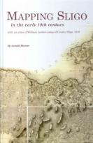
MAPPING SLIGO
€35.00
Mapping Sligo in the Early 19th Century is a book that would be an ideal gift or one to place at home on your coffee table. Mapping Sligo gives an insight into how Sligo was portrayed through the eyes of William Larkin. Larkin, a road engineer and surveyor took upon it himself to map Sligo, decades before the Ordnance Survey came into being. Maps are shown of where forts, churches, mills and other structures are in Sligo. Some details of fields & landscape in the area can be seen also. ?Although not perfect in dimension and scale it gives a view into how Sligo looked in the early 1800s. Dr. Arnold Horner gives us a book rich in local knowledge, with maps & portraits of a Sligo changed by time and one that any local would be proud to own.
Out of stock
HORNER, ARNOLD
Format: BK
ISBN: 9781905569526


